City of Santa Clara: Efficiency, Savings & Improved Services
For more than a decade, Arini Geographics has partnered with the City of Santa Clara to demonstrate how GIS, when aligned with strategy and operations, becomes a true business asset. The results are clear: greater efficiency, measurable cost savings, and improved services for both staff and residents.
At the core of this transformation is the Enterprise Geospatial Management System (EGMS), the City’s single source of truth for more than 280 datasets. Supported by a governance framework that ensures data integrity and consistency, the EGMS enhances permitting, asset management, inspections, and public safety while connecting departments through shared information.
We also worked with the City to modernize field operations using mobile-first tools that enable inspections, inventories, and environmental data collection in real time, and developed decision-support dashboards that turn complex datasets into actionable insights. Together, these initiatives reflect our integrated approach - strategy, system integration, data management, and field collection - all driving measurable value across the organization.
These accomplishments form the cornerstone of our collaborative success. They also position the City of Santa Clara as a leader in municipal GIS innovation, proving how the Power of Place can deliver lasting impact for governments and communities.
For more than a decade, Arini Geographics has partnered with the City of Santa Clara to transform GIS into a business-critical platform. Our work spans strategy, systems, data, and field operations - all aligned to support efficiency, transparency, and smarter decision-making.

With 82,000 maximum capacity, and year-round events, Levi’s Stadium is one of the NFL’s busiest venues, and a complex environment for public safety. Since its opening in 2014, through the Super Bowl 50 in 2016, Arini Geographics has supported the City of Santa Clara with the Common Operational Picture (COP), which unifies live feeds from dispatch, vehicle tracking, traffic cameras, and stadium systems into a single map-based dashboard.
For the past 12 years, the COP has been the trusted operational backbone for every 49ers home game and major concerts, and other sporting events, empowering City leaders and first responders with the real-time insight they need to act quickly, coordinate effectively and protect tens of thousands of fans, as well as citizens and visitors alike.
As Santa Clara prepares for Super Bowl 60 and the FIFA World Cup, Arini Geographics continues to evolve the COP with new informational layers, mobile interfaces, and enhanced dashboards, ensuring world-class safety and operational excellence on the global stage.
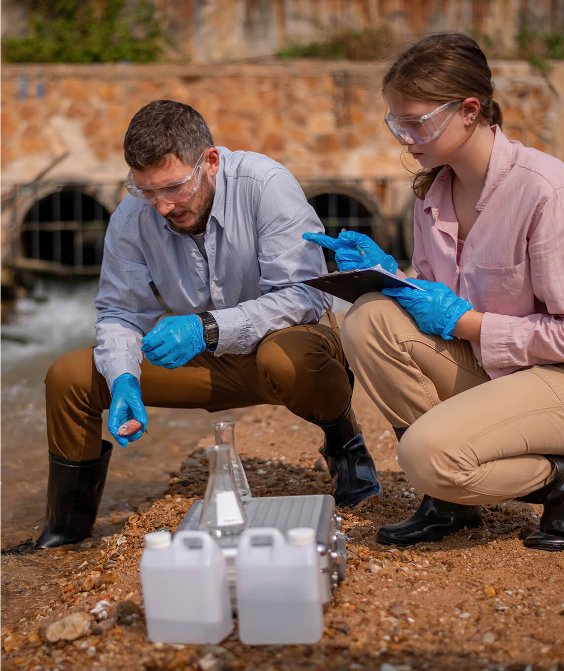
Thanks to its partnership with Arini Geographics, the Contra Costa Clean Water Program (CCCWP), which works to protect the waterways around the San Francisco Bay, is now armed with geospatial solutions that simplify stormwater compliance and enable seamless, program-wide reporting.
Since 2023, we’ve modernized the program’s GIS environment by migrating critical data into a secure cloud platform. This has streamlined usability, and created consistent, high-quality datasets accessible across all 21 of its member agencies. Today, staff and permittees use custom dashboards, mobile apps, and automated workflows to conduct inspections, track adherence to best management practices, and meet Municipal Regional Permit requirements with confidence.
By integrating GIS with regulatory reporting and providing ongoing system administration, QA/QC, and training, Arini Geographics ensures the agency has a sustainable, scalable platform that reduces risk, improves efficiency, and strengthens regional collaboration while protecting the environment.
Greentree Foundation, which facilitates meetings and discussions with leaders, scholars, and NGOs to advance human rights, justice, and cooperation among nations, now operates with a more efficient and intuitive geospatial platform that strengthens ecological management and efficiency across its entire 400-acre Long Island, NY property.
We designed and maintain an integrated ArcGIS Online environment that enables staff and consultants to capture, analyze, and act on critical environmental data, from mapping utilities and managing landscapes to monitoring wildlife habitats and assessing tree health. By aligning ecological expertise with robust GIS architecture, we provide Greentree with real-time insights, streamlined workflows, and collaborative tools that improve field operations and support informed decision-making.
Beyond tool development, our ongoing administration, QA/QC, and tailored enhancements ensure the system evolves with Greentree’s needs, positioning the foundation to achieve its environmental goals with clarity, precision, and sustainability.
Let’s start the conversation.